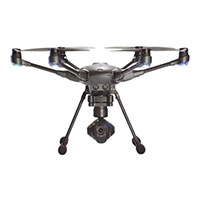
Ready to Travel
Rugged for commercial jobs but compact for ultimate mobility, the Intel® Falcon™ 8+ system features high quality industrial design for professional use. Payloads are easily exchangeable in the field, and Intel® Powerpack Batteries are designed for portability on airline flights.
Precision Data
With professional payload options the Intel® Falcon™ 8+ drone provides detailed data for orthography and 3D reconstruction, with millimeter accuracy for ground sample distance (GSD). The unique, patented V-shaped design helps ensure unobstructed data capture and enables a greater than 180 degree view from top to bottom for a range of perspectives, from one camera, in one flight. And for data privacy, the Falcon 8+ system can be configured as a closed system with isolated, on-board data storage that does not transmit data over the public internet.
Best-in-Class Safety
The Intel® Falcon™ 8+ UAV is designed for superior safety with industry-leading electronic and hardware system redundancy. The AscTec* Trinity Control Unit provides three redundant IMUs, for quick and reliable data fusion which verifies and controls the drone’s position, altitude, and orientation, for better responsiveness and stability during flights. It also features additional redundancies for communications, batteries, rotors, and motors.
Complex Flight Planning
The AscTec* Navigator flight-planning software enables high-area output. Prepare complex waypoint missions on your laptop to automate survey flights.
Path Planning with Exact Way-points
WP/Path function creates an exact reproduction of aerial imaging. Several photo positions, including camera orientation, can be saved as single waypoints or as complex paths with many waypoints, thus providing an automated process to repeat the flight.
Circle of Interest (COI)
The Circle of Interest (COI) function generates a circular waypoint flight to enable the systematic capturing of images around the point of interest according to your setting.
Quick Survey
This tool supports a fast and automated survey flight without a laptop. Simply enter the required parameters such as ground sample distance, then define coordinates of start and final angle via Intel® Cockpit Controller; the Intel® Falcon™ 8+ drone will automatically set flight altitude, speed, GPS-based photo positions and overlapping to provide the desired results within the shortest flight time.
Survey Package
The highest resolution for mapping, surveying and inspections.
SONY ALPHA 7R
With a precise 36 Megapixel full-frame DSLM camera, the SONY Alpha 7R comes equipped with Sony Sonar T* FE 35mm f/2.8 ZA Lens with Carl Zeiss T* anit-reflective coating in combination with a 35 mm full-frame sensor and BIONZ X* image processor
Survey Functions
Complex Flight Planning: The Falcon 8+ Survey Bundle features the AscTec Navigator flight planning software, which enables high area output. You can prepare complex way-point missions on your laptop to automate precise survey flight paths.
Quick Survey
The Quick Survey tool supports a fast and automated survey flight without a laptop. Simply enter the required parameters such as ground sample distance, then define the coordinates of start and final angle via Intel Cockpit Control Station; the Falcon 8+ will automatically set flight altitude, speed, GPS based photo positions and overlapping to provide the desired results within the shortest flight time.